Country:
 Serbia
Region:
City:
Latitude and Longitude:
Time Zone:
Postal Code:
IP information under different IP Channel
ip-api
Country
Region
City
ASN
Time Zone
ISP
Blacklist
Proxy
Latitude
Longitude
Postal
Route
IPinfo
Country
Region
City
ASN
Time Zone
ISP
Blacklist
Proxy
Latitude
Longitude
Postal
Route
MaxMind
Country
Region
City
ASN
Time Zone
ISP
Blacklist
Proxy
Latitude
Longitude
Postal
Route
Luminati
Country
RSRegion
00
City
belgrade
ASN
Time Zone
Europe/Belgrade
ISP
CETIN Ltd. Belgrade
Latitude
Longitude
Postal
db-ip
Country
Region
City
ASN
Time Zone
ISP
Blacklist
Proxy
Latitude
Longitude
Postal
Route
ipdata
Country
Region
City
ASN
Time Zone
ISP
Blacklist
Proxy
Latitude
Longitude
Postal
Route
Popular places and events near this IP address

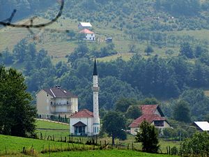
Tutin, Serbia
Town and municipality in Šumadija and Western Serbia, Serbia
Distance: Approx. 411 meters
Latitude and longitude: 42.98972222,20.33638889
Tutin (Serbian Cyrillic: Тутин) is a town and municipality located in the Raška District of southwestern Serbia. According to the 2022 census, the municipality has a population of 33,053 people, while the town has a population of 11,169.
Bujkoviće
Village in Raška District, Serbia
Distance: Approx. 1450 meters
Latitude and longitude: 42.99583333,20.31527778
Bujkoviće is a village in the municipality of Tutin, Serbia. According to the 2002 census, the village has a population of 53 people.
Dubovo (Tutin)
Village in Raška District, Serbia
Distance: Approx. 3171 meters
Latitude and longitude: 43.01666667,20.31666667
Dubovo is a village in the municipality of Tutin, Serbia. According to the 2002 census, the village has a population of 916 people.
Dulebe (Tutin)
Village in Raška District, Serbia
Distance: Approx. 4050 meters
Latitude and longitude: 42.95416667,20.33722222
Dulebe is a village in the municipality of Tutin, Serbia. According to the 2002 census, the village has a population of 56 people.

Južni Kočarnik
Village in Raška District, Serbia
Distance: Approx. 2636 meters
Latitude and longitude: 42.96666667,20.33333333
Južni Kočarnik is a village in the municipality of Tutin, Serbia. According to the 2002 census, the village has a population of 41 people.
Lukavica (Tutin)
Village in Raška District, Serbia
Distance: Approx. 563 meters
Latitude and longitude: 42.99222222,20.325
Lukavica is a village in the municipality of Tutin, Serbia. According to the 2002 census, the village has a population of 242 people.

Ostrovica (Tutin)
Village in Raška District, Serbia
Distance: Approx. 3892 meters
Latitude and longitude: 43.01666667,20.3
Ostrovica is a village in the municipality of Tutin, Serbia. According to the 2002 census, the village has a population of 40 people.
Paljevo (Tutin)
Village in Raška District, Serbia
Distance: Approx. 4364 meters
Latitude and longitude: 43,20.38333333
Paljevo is a village in the municipality of Tutin, Serbia. According to the 2002 census, the village has a population of 369 people.

Severni Kočarnik
Village in Raška District, Serbia
Distance: Approx. 601 meters
Latitude and longitude: 42.985,20.33
Severni Kočarnik is a village in the municipality of Tutin, Serbia. According to the 2002 census, the village has a population of 821 people.
Velje Polje (Tutin)
Village in Raška District, Serbia
Distance: Approx. 2000 meters
Latitude and longitude: 42.98472222,20.30805556
Velje Polje is a village in the municipality of Tutin, Serbia. According to the 2002 census, the village has a population of 251 people.
Žirče
Village in Raška District, Serbia
Distance: Approx. 3303 meters
Latitude and longitude: 43.01666667,20.35
Žirče is a village in the municipality of Tutin, Serbia. According to the 2002 census, the village has a population of 370 people.
Župa (Tutin)
Village in Raška District, Serbia
Distance: Approx. 2656 meters
Latitude and longitude: 42.98194444,20.36194444
Župa is a village in the municipality of Tutin, Serbia. According to the 2002 census, the village has a population of 344 people.
Weather in this IP's area
clear sky
18 Celsius
17 Celsius
18 Celsius
18 Celsius
1021 hPa
63 %
1021 hPa
923 hPa
10000 meters
2.09 m/s
1.91 m/s
272 degree
05:26:34
20:03:30