Country:
 Russian Federation
Region:
City:
Latitude and Longitude:
Time Zone:
Postal Code:
IP information under different IP Channel
ip-api
Country
Region
City
ASN
Time Zone
ISP
Blacklist
Proxy
Latitude
Longitude
Postal
Route
IPinfo
Country
Region
City
ASN
Time Zone
ISP
Blacklist
Proxy
Latitude
Longitude
Postal
Route
MaxMind
Country
Region
City
ASN
Time Zone
ISP
Blacklist
Proxy
Latitude
Longitude
Postal
Route
Luminati
Country
RURegion
klu
City
kaluga
ASN
Time Zone
Europe/Moscow
ISP
Rostelecom
Latitude
Longitude
Postal
db-ip
Country
Region
City
ASN
Time Zone
ISP
Blacklist
Proxy
Latitude
Longitude
Postal
Route
ipdata
Country
Region
City
ASN
Time Zone
ISP
Blacklist
Proxy
Latitude
Longitude
Postal
Route
Popular places and events near this IP address
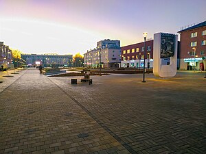
Obninsk
City in Kaluga Oblast, Russia
Distance: Approx. 418 meters
Latitude and longitude: 55.09305556,36.61055556
Obninsk (Russian: О́бнинск) is a city in Kaluga Oblast, Russia, located on the bank of the Protva River 100 kilometers (62 mi) southwest of Moscow and 80 kilometers (50 mi) northeast of Kaluga. Its population is 125,376 at the 2021 census.

Obninsk Meteorological tower
Mast in Obninks, Russia
Distance: Approx. 1817 meters
Latitude and longitude: 55.11166667,36.59833333
Obninsk Meteorological Tower is a 310 meter tall silver-grey guyed steel tube mast at Obninsk, Russia. Obninsk Meteorological Tower was built in 1958 and is equipped with multiple platforms on different heights, on which devices for measuring radioactivity and for meteorological science are installed. Obninsk Meteorological Tower is the official landmark of the Russian science town Obninsk.
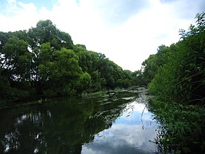
Luzha
River in Russia
Distance: Approx. 4621 meters
Latitude and longitude: 55.06111111,36.57305556
The Luzha (Russian: Лужа) is a river in Kaluga Oblast, Russia, which originates in Moscow Oblast. It is a right tributary of the Protva (in the Oka river basin). The Luzha has a length of 159 km (99 mi) and a drainage basin area of 1,400 km2 (540 sq mi).
Obninsk Nuclear Power Plant
Nuclear power plant in Obninsk, Russia (operates 1954–2002)
Distance: Approx. 2854 meters
Latitude and longitude: 55.08388889,36.57138889
Obninsk Nuclear Power Plant (Russian: Обнинская АЭС, romanized: Obninskaja AES; ) was built in the "Science City" of Obninsk, Kaluga Oblast, about 110 km (68 mi) southwest of Moscow, Soviet Union. Connected to the power grid in June 1954, Obninsk was the first grid-connected nuclear power plant in the world, i.e. the first nuclear reactor that produced electricity industrially, albeit at small scale.

Obninsk Institute for Nuclear Power Engineering
University in Obninsk, Russia
Distance: Approx. 4506 meters
Latitude and longitude: 55.13722222,36.60638889
Obninsk Institute for Nuclear Power Engineering (Russian: Обнинский институт атомной энергетики, traditionally abbreviated ИАТЭ) is an institution of higher education located in Obninsk. It began as a branch of the Moscow Engineering and Physics Institute in 1953 to provide specialists in the field of nuclear physics, reactor physics and reactor engineering for the Soviet Union's growing nuclear industry. The education was provided in close cooperation with nuclear-related research institutions in Obninsk.
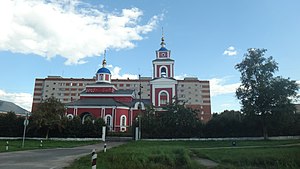
Belousovo, Kaluga Oblast
Town in Kaluga Oblast, Russia
Distance: Approx. 3903 meters
Latitude and longitude: 55.08333333,36.66666667
Belousovo (Russian: Белоу́сово) is a town in Zhukovsky District of Kaluga Oblast, Russia. Population: 10,946 (2021 Census); 8,412 (2010 Russian census); 8,515 (2002 Census); 11,886 (1989 Soviet census).
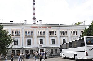
Geophysical Service of the Russian Academy of Sciences
Distance: Approx. 3288 meters
Latitude and longitude: 55.115,36.56944444
Geophysical Service of the Russian Academy of Sciences (Russian: Федеральный исследовательский центр «Единая геофизическая служба Российской академии наук» (ФИЦ ЕГС РАН)) is a research body responsible for geological research.

Spas-Zagorye
Place in Kaluga Oblast, Russia
Distance: Approx. 5205 meters
Latitude and longitude: 55.05111111,36.59277778
Spas-Zagorye is a village, administrative centre of rural settlements in the municipal area of Maloyaroslavetsky District of the Kaluga region, Russia. The village of Spas-Zagorye, located on the bend of the Protva river, 9.5 km from Maloyaroslavets and 3 km from Obninsk.
Weather in this IP's area
scattered clouds
17 Celsius
17 Celsius
17 Celsius
17 Celsius
1001 hPa
93 %
1001 hPa
981 hPa
10000 meters
3.13 m/s
8.05 m/s
256 degree
49 %
04:36:59
20:42:51