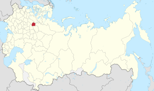
Country:
 Russian Federation
Region:
City:
Latitude and Longitude:
Time Zone:
Postal Code:
IP information under different IP Channel
ip-api
Country
Region
City
ASN
Time Zone
ISP
Blacklist
Proxy
Latitude
Longitude
Postal
Route
IPinfo
Country
Region
City
ASN
Time Zone
ISP
Blacklist
Proxy
Latitude
Longitude
Postal
Route
MaxMind
Country
Region
City
ASN
Time Zone
ISP
Blacklist
Proxy
Latitude
Longitude
Postal
Route
Luminati
Country
RURegion
yar
City
rybinsk
ASN
Time Zone
Europe/Moscow
ISP
Rostelecom
Latitude
Longitude
Postal
db-ip
Country
Region
City
ASN
Time Zone
ISP
Blacklist
Proxy
Latitude
Longitude
Postal
Route
ipdata
Country
Region
City
ASN
Time Zone
ISP
Blacklist
Proxy
Latitude
Longitude
Postal
Route
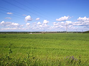
Popular places and events near this IP address

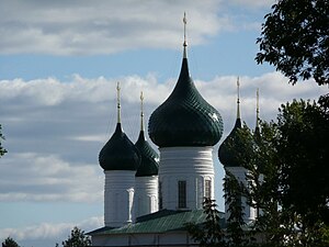
Yaroslavl
City in Yaroslavl Oblast, Russia
Distance: Approx. 2061 meters
Latitude and longitude: 57.61666667,39.85
Yaroslavl (Russian: Ярославль, IPA: [jɪrɐˈsɫavlʲ]) is a city and the administrative center of Yaroslavl Oblast, Russia, located 250 kilometers (160 mi) northeast of Moscow. The historic part of the city is a World Heritage Site, and is located at the confluence of the Volga and the Kotorosl rivers. It is part of the Golden Ring, a group of historic cities northeast of Moscow that have played an important role in Russian history.

Shinnik Stadium
Football stadium in Yaroslavl, Russia
Distance: Approx. 399 meters
Latitude and longitude: 57.628729,39.867486
The Shinnik Stadium is a multi-purpose stadium in Yaroslavl, Russia. It is currently used mostly for football matches and is the home ground of FC Shinnik Yaroslavl. The stadium holds 22,990 people.
Yaroslavl State University
University in Yaroslavl, Russia
Distance: Approx. 861 meters
Latitude and longitude: 57.63277778,39.88722222
The Yaroslavl Demidov State University (Russian: Ярославский государственный университет имени П. Г. Демидова) is an institution of higher education in Yaroslavl, Russia. In 1918, Yaroslavl Demidov State University became a successor university to the Demidov Lyceum, which was founded in 1803.
Demidovsky Pillar, Yaroslavl
Doric column in Yaroslavl, Russia
Distance: Approx. 1520 meters
Latitude and longitude: 57.62504,39.89722
The Demidovsky Pillar in Yaroslavl is a bronze Doric column set up as a memorial to Pavel Grigoryevich Demidov - founder of the Yaroslavl Demidov School of Higher Sciences. It was set up on 6 (18) March 1829 in Ilyinsky Square in Yaroslavl from funds given by the town's inhabitants and other voluntary donors. It is 12m high on a granite base, with its interior filled up with sand and its top crowned with a bronze armillary sphere with a gilded eagle perching on it.

Yaroslavl State Medical Academy
Building
Distance: Approx. 1504 meters
Latitude and longitude: 57.6243,39.8963
Yaroslavl State Medical University (YSMU) (Russian: Ярославский государственный медицинский университет (ЯГМУ)) is a university in Yaroslavl, a city in European part of Russia. It was founded in 1944. YSMU is a regional center of medical education and bio-medical research.

Church of Saint Nicetas, Yaroslavl
Distance: Approx. 765 meters
Latitude and longitude: 57.623781,39.868998
The Church of St. Nicetas (церковь Никиты Столпника) is a Russian Orthodox church of St. Nicetas the Goth on Victory Street in Yaroslavl.

Church of St. Nicholas in Tropino
Distance: Approx. 2184 meters
Latitude and longitude: 57.613101,39.891561
The Church of St. Nicholas in Tropino (Николо-Тропинская церковь) is a ruined 17th-century church on the right bank of the Kotorosl River in Yaroslavl. It has been expanded and renovated on several occasions in the 18th and 19th centuries.
Ascension Church, Yaroslavl
Distance: Approx. 479 meters
Latitude and longitude: 57.62619,39.87067
The Church of the Ascension of Christ (Вознесенская церковь) is a four-piered penticupolar Orthodox church erected in Kondakovo, a western suburb of Yaroslavl between 1677 and 1682. The first church on the site was commissioned in 1584 by Basil Kondaki, a wealthy Greek merchant, in order to prevent the planned construction of a Lutheran church in Kondakovo. A smaller parish church is dedicated to the Presentation of Jesus at the Temple.
Yaroslavsky District, Yaroslavl Oblast
District in Yaroslavl Oblast, Russia
Distance: Approx. 2061 meters
Latitude and longitude: 57.61666667,39.85
Yaroslavsky District (Russian: Яросла́вский райо́н) is an administrative and municipal district (raion), one of the seventeen in Yaroslavl Oblast, Russia. It is located in the east of the oblast. The area of the district is 1,936.7 square kilometers (747.8 sq mi).
Yaroslavl Governorate
1777–1929 unit of Russia
Distance: Approx. 2059 meters
Latitude and longitude: 57.6167,39.85
Yaroslavl Governorate (Russian: Ярославская губерния, romanized: Yaroslavskaya guberniya) was an administrative-territorial unit (guberniya) of the Russian Empire and the Russian SFSR, located in European Russia in the Upper Volga Region. It existed from 1777 to 1929; its seat was in the city of Yaroslavl.

Volzhskaya tower
Monument in Yaroslavl, Russia
Distance: Approx. 1755 meters
Latitude and longitude: 57.625,39.90138889
Volzhskaya tower (Russian: Волжская башня), or Arsenalnaya tower (Russian: Арсенальная башня), is one of the three surviving towers of the fortifications of the Zemlyanoy town (posad) of Yaroslavl. Initially, in the 16th century, six gated towers and twenty blank wooden towers were built on the ramparts.

Lutheran Church of Saint Peter and Saint Paul (Yaroslavl)
Lutheran church in Yaroslavl
Distance: Approx. 26 meters
Latitude and longitude: 57.63032,39.87397
Church of Saints Peter and Paul (Russian: Церковь Святых Петра и Павла also known as Кирха Петра и Павла.)— is an Evangelical Lutheran church in Yaroslavl, Russia. It was built in the 1840s at the corner of Borisoglebskaya and Lyubimskaya streets. It is the last work of the architect Peter Pankov and has been identified as an object of cultural heritage in Russia.
Weather in this IP's area
scattered clouds
22 Celsius
22 Celsius
22 Celsius
22 Celsius
999 hPa
83 %
999 hPa
988 hPa
10000 meters
1 m/s
130 degree
40 %
04:10:10
20:43:33