Country:
 France
Region:
City:
Latitude and Longitude:
Time Zone:
Postal Code:
IP information under different IP Channel
ip-api
Country
Region
City
ASN
Time Zone
ISP
Blacklist
Proxy
Latitude
Longitude
Postal
Route
IPinfo
Country
Region
City
ASN
Time Zone
ISP
Blacklist
Proxy
Latitude
Longitude
Postal
Route
MaxMind
Country
Region
City
ASN
Time Zone
ISP
Blacklist
Proxy
Latitude
Longitude
Postal
Route
Luminati
Country
FRRegion
occ
City
montcuq
ASN
Time Zone
Europe/Paris
ISP
Ses Astra S.A.
Latitude
Longitude
Postal
db-ip
Country
Region
City
ASN
Time Zone
ISP
Blacklist
Proxy
Latitude
Longitude
Postal
Route
ipdata
Country
Region
City
ASN
Time Zone
ISP
Blacklist
Proxy
Latitude
Longitude
Postal
Route
Popular places and events near this IP address

Eygurande-et-Gardedeuil
Commune in Nouvelle-Aquitaine, France
Distance: Approx. 7170 meters
Latitude and longitude: 45.0678,0.1222
Eygurande-et-Gardedeuil (French pronunciation: [ɛɡyʁɑ̃d e ɡaʁdədœj]; Occitan: Eiguranda e Gardadelh) is a commune in the Dordogne department in Nouvelle-Aquitaine in southwestern France.

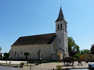
Ménesplet
Commune in Nouvelle-Aquitaine, France
Distance: Approx. 3324 meters
Latitude and longitude: 45.0181,0.1089
Ménesplet is a commune in the Dordogne department in Nouvelle-Aquitaine in southwestern France.

Minzac
Commune in Nouvelle-Aquitaine, France
Distance: Approx. 5330 meters
Latitude and longitude: 44.9733,0.0381
Minzac (French pronunciation: [mɛ̃zak]) is a commune in the Dordogne department in Nouvelle-Aquitaine in southwestern France.
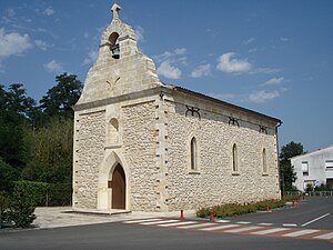
Le Pizou
Commune in Nouvelle-Aquitaine, France
Distance: Approx. 1052 meters
Latitude and longitude: 45.0258,0.0631
Le Pizou (French pronunciation: [lə pizu]; Occitan: Lo Pison) is a commune in the Dordogne department in Nouvelle-Aquitaine in southwestern France.
Moulin-Neuf, Dordogne
Commune in Nouvelle-Aquitaine, France
Distance: Approx. 1305 meters
Latitude and longitude: 45.0117,0.0517
Moulin-Neuf (French pronunciation: [mulɛ̃ nœf]; Occitan: Molin Nuòu) is a commune in the Dordogne department in Nouvelle-Aquitaine in southwestern France. It is about 50 km northeast of Bordeaux.

Gours, Gironde
Commune in Nouvelle-Aquitaine, France
Distance: Approx. 4223 meters
Latitude and longitude: 44.9944,0.0233
Gours is a commune in the Gironde department in southwestern France.

Porchères
Commune in Nouvelle-Aquitaine, France
Distance: Approx. 4640 meters
Latitude and longitude: 45.0306,0.0111
Porchères (French pronunciation: [pɔʁʃɛʁ]) is a commune in the Gironde department in Nouvelle-Aquitaine in southwestern France.

Puynormand
Commune in Nouvelle-Aquitaine, France
Distance: Approx. 6396 meters
Latitude and longitude: 44.9836,0.00028
Puynormand (French pronunciation: [pɥinɔʁmɑ̃]; Occitan: Pueinarmand) is a commune in the Gironde department in Nouvelle-Aquitaine in southwestern France.

Saint-Antoine-sur-l'Isle
Commune in Nouvelle-Aquitaine, France
Distance: Approx. 2512 meters
Latitude and longitude: 45.0278,0.0389
Saint-Antoine-sur-l'Isle (French pronunciation: [sɛ̃.t‿ɑ̃twan syʁ lil], literally Saint-Antoine on the Isle; Occitan: Sent Antòni d'Eila) is a commune in the Gironde department in Nouvelle-Aquitaine in southwestern France.
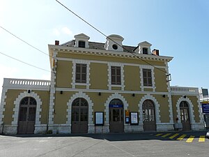
Saint-Seurin-sur-l'Isle
Commune in Nouvelle-Aquitaine, France
Distance: Approx. 5296 meters
Latitude and longitude: 45.015,-0.00056
Saint-Seurin-sur-l'Isle (French pronunciation: [sɛ̃ sœʁɛ̃ syʁ lil], literally Saint Seurin on the Isle) is a commune in the Gironde department in Nouvelle-Aquitaine in southwestern France. Saint-Seurin-sur-l'Isle station has rail connections to Bordeaux, Périgueux, Brive-la-Gaillarde and Limoges.
Montpon-Ménestérol station
Distance: Approx. 7367 meters
Latitude and longitude: 45.00638889,0.15916667
Montpon-Ménestérol is a railway station in Montpon-Ménestérol, Nouvelle-Aquitaine, France. The station is located on the Coutras - Tulle railway line.

Saint-Seurin-sur-l'Isle station
Distance: Approx. 5496 meters
Latitude and longitude: 45.01166667,-0.00277778
Saint-Seurin-sur-l'Isle is a railway station in Saint-Seurin-sur-l'Isle, Nouvelle-Aquitaine, France. The station is located on the Coutras - Tulle railway line.
Weather in this IP's area
few clouds
34 Celsius
35 Celsius
34 Celsius
35 Celsius
1016 hPa
38 %
1016 hPa
1013 hPa
10000 meters
1.59 m/s
2.13 m/s
93 degree
16 %
06:40:45
21:31:28