Country:
 USA
USARegion:
City:
Latitude and Longitude:
Time Zone:
Postal Code:
IP information under different IP Channel
ip-api
Country
Region
City
ASN
Time Zone
ISP
Blacklist
Proxy
Latitude
Longitude
Postal
Route
IPinfo
Country
Region
City
ASN
Time Zone
ISP
Blacklist
Proxy
Latitude
Longitude
Postal
Route
MaxMind
Country
Region
City
ASN
Time Zone
ISP
Blacklist
Proxy
Latitude
Longitude
Postal
Route
Luminati
Country
USRegion
ca
City
losangeles
ASN
Time Zone
America/Los_Angeles
ISP
EDGECAST
Latitude
Longitude
Postal
db-ip
Country
Region
City
ASN
Time Zone
ISP
Blacklist
Proxy
Latitude
Longitude
Postal
Route
ipdata
Country
Region
City
ASN
Time Zone
ISP
Blacklist
Proxy
Latitude
Longitude
Postal
Route
Popular places and events near this IP address

Buena Vista, San Jose
Neighborhood of San Jose in Santa Clara, California, United States
Distance: Approx. 1339 meters
Latitude and longitude: 37.32138889,-121.91666667
Buena Vista (Spanish for "Good View") is a former census-designated place (CDP) in Santa Clara County, California, United States. The population was 1,704 at the 2000 census. The area is now part of the city of San Jose.

Fruitdale, San Jose
Place in California, United States
Distance: Approx. 1230 meters
Latitude and longitude: 37.31277778,-121.93583333
Fruitdale is a district of San Jose, California, though some portions are still unincorporated as a census-designated place. The population of the CDP was 935 at the 2010 census.

Burbank, Santa Clara County, California
Place in California, United States
Distance: Approx. 306 meters
Latitude and longitude: 37.32055556,-121.93166667
Burbank is a unincorporated community in Santa Clara County, California. As an urban Island, it is surrounded by the city of San Jose. The population was 4,926 at the 2010 census.

Rosicrucian Egyptian Museum
Museum in San Jose, California
Distance: Approx. 1418 meters
Latitude and longitude: 37.3342,-121.9233
The Rosicrucian Egyptian Museum (REM) is devoted to ancient Egypt, located at Rosicrucian Park in the Rose Garden neighborhood of San Jose, California, United States. It was founded by the Ancient Mystical Order Rosae Crucis (AMORC). The Rosicrucian order continues to support and expand the museum and its educational and scientific activities.
San Jose City College
Community college in San Jose, California, US
Distance: Approx. 998 meters
Latitude and longitude: 37.3148,-121.928
San José City College (SJCC) is a public community college in San Jose, California. It was founded in 1921, and is one of the oldest colleges in the California Community College System.

Santana Row
Neighborhood of San Jose in Santa Clara County, California, United States
Distance: Approx. 1471 meters
Latitude and longitude: 37.32027778,-121.94777778
Santana Row (abbreviated as SR or The Row) is an upscale residential and commercial district of West San Jose in San Jose, California. Santana Row is intersected by Stevens Creek Boulevard, a major thoroughfare, and close to local landmarks like Westfield Valley Fair and the Winchester Mystery House.
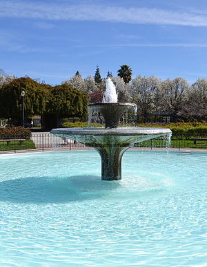
San Jose Municipal Rose Garden
Distance: Approx. 979 meters
Latitude and longitude: 37.33176,-121.92859
The San Jose Municipal Rose Garden is a historic rose garden in San Jose, California, in the Rose Garden District. Founded in 1927, the garden is exclusively dedicated to roses and features more than 3,500 shrubs representing 189 rose varieties. The AARS named the SJ Municipal Rose Garden as "America's Best Rose Garden", making it the winner in the first nationwide competition ever.

Abraham Lincoln High School (San Jose, California)
Public school in San Jose, California, United States
Distance: Approx. 902 meters
Latitude and longitude: 37.32833333,-121.92361111
Abraham Lincoln High School is a high school located in San Jose, California, in the San Jose Unified School District. It is a magnet school for "Academic, Visual, and Performing Arts" (AVPA).
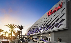
Westfield Valley Fair
Shopping mall in California, USA
Distance: Approx. 986 meters
Latitude and longitude: 37.325095,-121.942508
Westfield Valley Fair, commonly known as Valley Fair, is a prominent shopping mall in San Jose, California. Valley Fair is the largest mall, by area, in Northern California and has higher sales revenue than all other malls in California, including the two in Southern California which have larger area than Valley Fair. Valley Fair is the thirteenth largest shopping mall in the United States.
O'Connor Hospital
Hospital in California, United States
Distance: Approx. 797 meters
Latitude and longitude: 37.3279,-121.9385
O'Connor Hospital is a hospital in San Jose, California, part of the Santa Clara County Health System. Located in the West San Carlos neighborhood of San Jose, O'Connor Hospital is one of the oldest hospitals in Santa Clara County, founded in 1889.
Santa Clara Valley Medical Center
Hospital in California, United States
Distance: Approx. 1128 meters
Latitude and longitude: 37.31333333,-121.93388889
Santa Clara Valley Medical Center, commonly known as Valley Medical Center or simply Valley Medical, is a prominent 731-bed public tertiary, teaching, and research hospital in San Jose, California. Located in the Fruitdale neighborhood of West San Jose, Valley Medical Center is the anchor facility of the Santa Clara County Health System, serving Santa Clara County. Valley Medical is home to numerous innovative research and care centers, such as the Rehabilitation Trauma Center, the only federally-designated spinal cord injury center in Northern California.
Rehabilitation Trauma Center
Hospital in California, United States
Distance: Approx. 1023 meters
Latitude and longitude: 37.314219,-121.933351
The Rehabilitation Trauma Center (RTC) at the Santa Clara Valley Medical Center (SCVMC) was founded in 1972 and is part of the only federally designated spinal cord injury center in Northern California. The center is one of the oldest spinal cord injury neurointensive care units in the United States and participated in the original National Institute on Disability and Rehabilitation Research Database collecting retrospective data to 1973. The center is currently a ten-bed unit based in the Sobrato Pavilion's Respiratory Rehabilitation Unit (opened in 2017) under the direction of Dr.
Weather in this IP's area
broken clouds
14 Celsius
14 Celsius
12 Celsius
16 Celsius
1014 hPa
81 %
1014 hPa
1010 hPa
10000 meters
4.12 m/s
160 degree
75 %
06:09:20
20:18:52