Country:
 USA
USARegion:
City:
Latitude and Longitude:
Time Zone:
Postal Code:
IP information under different IP Channel
ip-api
Country
Region
City
ASN
Time Zone
ISP
Blacklist
Proxy
Latitude
Longitude
Postal
Route
IPinfo
Country
Region
City
ASN
Time Zone
ISP
Blacklist
Proxy
Latitude
Longitude
Postal
Route
MaxMind
Country
Region
City
ASN
Time Zone
ISP
Blacklist
Proxy
Latitude
Longitude
Postal
Route
Luminati
Country
USRegion
fl
City
inletbeach
ASN
Time Zone
America/Chicago
ISP
UNITI-FIBER
Latitude
Longitude
Postal
db-ip
Country
Region
City
ASN
Time Zone
ISP
Blacklist
Proxy
Latitude
Longitude
Postal
Route
ipdata
Country
Region
City
ASN
Time Zone
ISP
Blacklist
Proxy
Latitude
Longitude
Postal
Route
Popular places and events near this IP address
Seaside, Florida
Unincorporated community in Florida, United States
Distance: Approx. 387 meters
Latitude and longitude: 30.320118,-86.137705
Seaside is an unincorporated master-planned community on the Florida Panhandle in Walton County, between Panama City Beach and Destin. One of the first communities in America designed on the principles of New Urbanism, the town has become the topic of slide lectures in architectural schools and in housing-industry magazines, and is visited by design professionals from all over the United States. On April 18, 2012, the American Institute of Architects's Florida Chapter placed the community on its list of Florida Architecture: 100 Years.

Deer Lake State Park
State park in Florida, United States
Distance: Approx. 6320 meters
Latitude and longitude: 30.30388889,-86.07888889
Deer Lake State Park is a Florida State Park located in Santa Rosa Beach, on CR 30A, in northwestern Florida. Its sister park is Grayton Beach State Recreation Area.
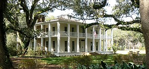
Eden Gardens State Park
Park and historic mansion in Florida, U.S.
Distance: Approx. 6626 meters
Latitude and longitude: 30.37805556,-86.12194444
Eden Gardens State Park is a 163 acres (0.66 km2) Florida State Park and historic site located in Point Washington, south of Freeport, off U.S. 98 on CR 395, in northwestern Florida at 181 Eden Gardens Road (CR 395) in Santa Rosa Beach. The park is centered on the Wesley House, a two-story mansion virtually surrounded by white columns and verandas. The house is notable for its furnishings, especially examples of late 18th century French furniture.

Grayton Beach State Park
State park in Florida, United States
Distance: Approx. 2114 meters
Latitude and longitude: 30.33333333,-86.15833333
Grayton Beach State Park is a Florida State Park located between Panama City Beach and Destin, near the unincorporated area of Grayton Beach, on CR 30A, in northwestern Florida. Its sister park is Deer Lake State Park. The 2,200 acres (9 km2) of land for the park was obtained from a lease from the Florida Board of Education in 1964 and opened in 1968.

Choctawhatchee River
River in Alabama and Florida, United States
Distance: Approx. 9379 meters
Latitude and longitude: 30.4038,-86.12355
The Choctawhatchee River is a 141-mile-long (227 km) river in the southern United States, flowing through southeast Alabama and the Panhandle of Florida before emptying into Choctawhatchee Bay in Okaloosa and Walton counties. The river, the bay and their adjacent watersheds collectively drain 5,350 square miles (13,900 km2).
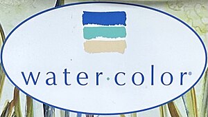
WaterColor, Florida
Unincorporated community in Florida, United States
Distance: Approx. 440 meters
Latitude and longitude: 30.3225,-86.14583333
WaterColor is an unincorporated master-planned community located in Walton County, Florida, United States, between Grayton Beach and Seaside. This 499-acre (202 ha) Southern resort and residential community was planned by Cooper, Robertson & Partners with Urban Design Associates, in collaboration with Nelson Byrd Woltz Landscape Architects, under the direction of The St. Joe Company.
Grayton Beach, Florida
Village in Florida, U.S.
Distance: Approx. 2907 meters
Latitude and longitude: 30.33,-86.17
Grayton Beach is a small, historic beach village on the Florida Panhandle Gulf coast halfway between Destin and Panama City in Walton County and adjacent to Grayton Beach State Park. Collectively, the area is known as the “Beaches of South Walton", with South Walton referring to the southern portion of Walton County below the Choctawhatchee Bay.
Santa Rosa Beach, Florida
Unincorporated community in Florida, United States
Distance: Approx. 4811 meters
Latitude and longitude: 30.361486,-86.159116
Santa Rosa Beach is an unincorporated community in Walton County, Florida, United States. It is part of the Crestview-Fort Walton Beach-Destin, Florida Metropolitan Statistical Area.
Point Washington, Florida
Unincorporated community in Florida, U.S.
Distance: Approx. 6052 meters
Latitude and longitude: 30.37027778,-86.115
Point Washington is an unincorporated community in Walton County, Florida, United States. Its zip code is: 32459. The area is home to Eden Gardens State Park.

Seagrove Beach, Florida
Unincorporated community in Florida, United States
Distance: Approx. 1120 meters
Latitude and longitude: 30.31861111,-86.13027778
Seagrove Beach, Florida is a two-mile-long beach community located on the Gulf of Mexico in Walton County, Florida, United States. It is located along Florida State Road 30A, east of Seaside and west of WaterSound. Seagrove Beach is recognized locally as an independent neighborhood, but its mailing address is Santa Rosa Beach.
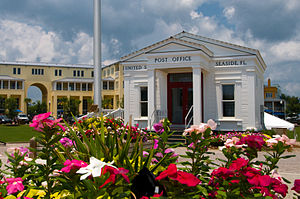
Seaside Post Office
Building in Florida, United States
Distance: Approx. 455 meters
Latitude and longitude: 30.32027778,-86.13694444
The Seaside Post Office is a prominent building located in the Central Square of Seaside, Florida. The building was constructed in 1985. In 2018 it was relocated to a different part of the Central Square.
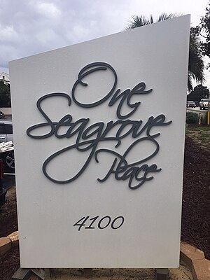
One Seagrove Place
Condominium in Seagrove Beach
Distance: Approx. 3327 meters
Latitude and longitude: 30.31055556,-86.10916667
One Seagrove Place is a high-rise condominium located in Seagrove Beach, Florida. It was constructed in 1985 and is the tallest building in South Walton County.
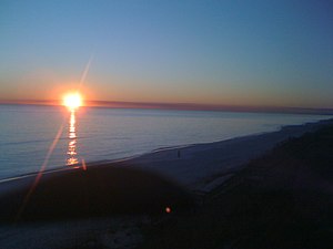
Weather in this IP's area
overcast clouds
26 Celsius
26 Celsius
25 Celsius
28 Celsius
1017 hPa
71 %
1017 hPa
1016 hPa
10000 meters
2.1 m/s
2.39 m/s
200 degree
99 %
06:00:10
19:41:44