Country:
 Australia
Region:
City:
Latitude and Longitude:
Time Zone:
Postal Code:
IP information under different IP Channel
ip-api
Country
Region
City
ASN
Time Zone
ISP
Blacklist
Proxy
Latitude
Longitude
Postal
Route
IPinfo
Country
Region
City
ASN
Time Zone
ISP
Blacklist
Proxy
Latitude
Longitude
Postal
Route
MaxMind
Country
Region
City
ASN
Time Zone
ISP
Blacklist
Proxy
Latitude
Longitude
Postal
Route
Luminati
Country
 CA
CARegion
ab
City
calgary
ASN
Time Zone
America/Edmonton
ISP
Equinix (EMEA) Acquisition Enterprises B.V.
Latitude
Longitude
Postal
db-ip
Country
Region
City
ASN
Time Zone
ISP
Blacklist
Proxy
Latitude
Longitude
Postal
Route
ipdata
Country
Region
City
ASN
Time Zone
ISP
Blacklist
Proxy
Latitude
Longitude
Postal
Route
Popular places and events near this IP address

Claremont, Western Australia
Suburb of Perth, Western Australia
Distance: Approx. 920 meters
Latitude and longitude: -31.98,115.782
Claremont is a western suburb of Perth, Western Australia, on the north bank of the Swan River.

Showgrounds railway station, Perth
Railway station in Perth, Western Australia
Distance: Approx. 1213 meters
Latitude and longitude: -31.976647,115.78723
Showgrounds railway station is a railway station on the Transperth network. It is located on the Fremantle line & Airport line , 8.6 kilometres from Perth station adjacent to the Claremont Showground. It is used only when events are held at the Showground, such as the Royal Show.

Claremont railway station, Perth
Railway station in Perth, Western Australia
Distance: Approx. 876 meters
Latitude and longitude: -31.980706,115.781415
Claremont railway station is a railway station on the Transperth network in Western Australia. It is located on the Fremantle and Airport lines, 9.3 kilometres from Perth station serving the suburb of Claremont.
Claremont Showground
Agricultural show grounds in Claremont, Western Australia
Distance: Approx. 1331 meters
Latitude and longitude: -31.975552,115.785504
The Claremont Showground near Perth, Western Australia is home to the annual Perth Royal Show. In 1902, 13 hectares (32 acres) of land were reserved in the Perth suburb of Claremont for a new showground to replace the Guildford Showgrounds. The Royal Agricultural Show, of three days, was first held there in October and November 1905.
Christ Church Grammar School
School in Australia
Distance: Approx. 843 meters
Latitude and longitude: -31.98666667,115.77722222
Christ Church Grammar School is a multi-campus independent Anglican single-sex early learning, primary and secondary day and boarding school for boys. Located in Perth, Western Australia, the school's main campus overlooks Freshwater Bay on the Swan River, in the suburb of Claremont. The school is a member of the Public Schools' Association (PSA), Independent Primary School Heads of Australia (IPSHA), Association of Independent Schools in Western Australia (AISWA), Association of Headmasters of Independent Schools Australia (AHISA) and Australian Boarding Schools' Association (ABSA).

Methodist Ladies' College, Perth
School in Claremont, Western Australia
Distance: Approx. 1024 meters
Latitude and longitude: -31.986754,115.775295
Methodist Ladies' College, Perth (MLC Perth), is an independent, Uniting Church, day and boarding school for girls, located in Claremont, a western suburb of Perth, Western Australia. Founded by the Methodist Church of Australia in 1907, MLC is a non-selective school, and in 2024, it had about 1,040 girls from pre-kindergarten to Year 12, including 90 boarders. The college was ranked as the number one TEE school in the state for 2006 and 2008 seeing 55.1 percent of students achieving a mark of seventy five percent or above in at least one subject.

Claremont Oval
Football stadium in Perth, Western Australia
Distance: Approx. 1075 meters
Latitude and longitude: -31.978247,115.782843
Claremont Oval, also known by naming rights sponsorship as Revo Fitness Stadium, is an Australian rules football stadium located in Perth, Western Australia. The stadium, opened in 1905 as "Claremont Recreation Ground", seats 5,000. It is the home of the Claremont Football Club, an Australian rules football club that plays in the Western Australian Football League (WAFL), the state's premier Australian rules competition.

Freshwater Bay (Western Australia)
Bay in the Swan River, Western Australia
Distance: Approx. 1230 meters
Latitude and longitude: -31.9975,115.78055556
Freshwater Bay is a bay of the Swan River, in metropolitan Perth, Western Australia. It is about 5 km upstream from the mouth of the river at Fremantle and is overlooked by the suburbs of Dalkeith, Claremont, Mosman Park and Peppermint Grove. Freshwater Bay was named after Freshwater Bay and Freshwater, Isle of Wight by Henry Charles Prinsep (1844-1922), who had a riverside family holiday cottage there, The Chine.

Town of Claremont
Local government area in Western Australia
Distance: Approx. 920 meters
Latitude and longitude: -31.98,115.782
The Town of Claremont is a local government area in the inner western suburbs of the Western Australian capital city of Perth, located about halfway between the port city of Fremantle and Perth's central business district. The Town covers an area of 4.9 square kilometres (1.9 sq mi), maintains 48 km of roads and 87 km of footpaths, and has a population of approximately 10,000 as at the 2016 Census.

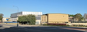
Claremont Teachers College
First post-secondary teaching institution in Western Australia
Distance: Approx. 197 meters
Latitude and longitude: -31.987135,115.788143
Claremont Teachers College was Western Australia’s first post-secondary teaching institution. It opened in 1902 and closed in 1981, when it became a College of Advanced Education then a campus of Edith Cowan University before being acquired by the University of Western Australia. The building is on land between Goldsworthy, Princess and Bay Roads in the western Perth, Western Australia suburb of Claremont.
St. Louis School, Claremont, Western Australia
Distance: Approx. 1118 meters
Latitude and longitude: -31.984,115.775
St. Louis School was a Catholic boys' school in Claremont, Western Australia, between 1938 and 1976.

Claremont Post Office
Historic site in Perth, Western Australia
Distance: Approx. 810 meters
Latitude and longitude: -31.9813,115.7816
Claremont Post Office is a heritage-listed post office at Bayview Terrace, Claremont, Western Australia, Australia. It was added to the Australian Commonwealth Heritage List on 22 June 2004.
Weather in this IP's area
broken clouds
15 Celsius
15 Celsius
14 Celsius
16 Celsius
1015 hPa
92 %
1015 hPa
1012 hPa
10000 meters
2.57 m/s
360 degree
75 %
07:08:33
17:37:55