Country:
Region:
City:
Latitude and Longitude:
Time Zone:
Postal Code:
IP information under different IP Channel
ip-api
Country
Region
City
ASN
Time Zone
ISP
Blacklist
Proxy
Latitude
Longitude
Postal
Route
IPinfo
Country
Region
City
ASN
Time Zone
ISP
Blacklist
Proxy
Latitude
Longitude
Postal
Route
MaxMind
Country
Region
City
ASN
Time Zone
ISP
Blacklist
Proxy
Latitude
Longitude
Postal
Route
Luminati
Country
ASN
Time Zone
Australia/Sydney
ISP
Host Universal Pty Ltd
Latitude
Longitude
Postal
db-ip
Country
Region
City
ASN
Time Zone
ISP
Blacklist
Proxy
Latitude
Longitude
Postal
Route
ipdata
Country
Region
City
ASN
Time Zone
ISP
Blacklist
Proxy
Latitude
Longitude
Postal
Route
Popular places and events near this IP address
Haileybury (Melbourne)
Independent day school in Australia
Distance: Approx. 1619 meters
Latitude and longitude: -37.99416667,145.14555556
Haileybury is an Australian private school with campuses in Keysborough, Brighton East, Berwick, Melbourne's CBD, Darwin, Northern Territory and online campus, Haileybury Pangea. It also has an international campus in the Tianjin outer district of Wuqing, China. Middle School (Years 5-8) at Haileybury introduces parallel education where students are separated into single-gender classrooms for their academic studies and for Sport and Camping programs.

Braeside, Victoria
Suburb of Melbourne, Victoria, Australia
Distance: Approx. 2088 meters
Latitude and longitude: -38,145.125
Braeside is a suburb in Melbourne, Victoria, Australia, 25 km south-east of Melbourne's Central Business District, located within the City of Kingston local government area. Braeside recorded a population of 25 at the 2021 census. Braeside is a largely industrial suburb with little residential areas.

Moorabbin Airport
Municipal airport serving Melbourne, Victoria, Australia
Distance: Approx. 2908 meters
Latitude and longitude: -37.97583333,145.10222222
Moorabbin (Harry Hawker) Airport (IATA: MBW, ICAO: YMMB) is a mostly general aviation airport for light aircraft located in between the southern Melbourne suburbs of Heatherton, Cheltenham, Dingley Village and Mentone. It also receives commercial airline service. The airport grounds are treated as their own suburb, and share the postcode 3194 with the neighbouring suburb of Mentone.
Springvale South, Victoria
Suburb of Melbourne, Victoria, Australia
Distance: Approx. 2099 meters
Latitude and longitude: -37.977,145.157
Springvale South is a suburb in Melbourne, Victoria, Australia, 24 km south-east of Melbourne's Central Business District, located within the City of Greater Dandenong local government area. Springvale South recorded a population of 12,766 at the 2021 census.
Dingley Village, Victoria
Suburb of Melbourne, Victoria, Australia
Distance: Approx. 576 meters
Latitude and longitude: -37.981,145.128
Dingley Village is a suburb in Melbourne, Victoria, Australia, 23 km south-east of Melbourne's Central Business District, located within the City of Kingston local government area. Dingley Village recorded a population of 10,495 at the 2021 census.
Heatherhill Secondary College
Government, coeducation school in Melbourne, Victoria, Australia
Distance: Approx. 1972 meters
Latitude and longitude: -37.97055556,145.15055556
Heatherhill Secondary College was a government coeducational school for students from years 7–12, located in Springvale South, Victoria. The school was established in 1966, and the campus was merged into Keysborough Secondary College on 6 October 2008.
Keysborough Secondary College
Australian school
Distance: Approx. 2315 meters
Latitude and longitude: -37.98166667,145.16055556
Keysborough Secondary College is an Australian dual campus government coeducational school for students from years 7–12, with campuses located in Springvale South, Victoria and Keysborough, Victoria. The four participating schools were officially merged into Keysborough Secondary College on 6 October 2008. The merger is valued at $43 million.
Lighthouse Christian College
School in Australia
Distance: Approx. 2211 meters
Latitude and longitude: -38.0014,145.1427
The Lighthouse Christian College is a private, non-denominational Christian co-educational early learning primary and secondary day school located in the Melbourne suburb of Keysborough, Victoria, Australia,

Braeside Park
Distance: Approx. 1763 meters
Latitude and longitude: -37.998,145.129
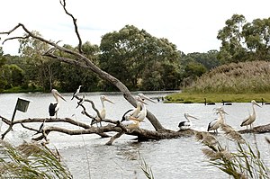
Braeside Park is a 310-hectare (770-acre) metropolitan, recreational and conservation park in the south-eastern Melbourne suburb of Braeside.

Electoral district of Keysborough
Former state electoral district of Victoria, Australia
Distance: Approx. 1607 meters
Latitude and longitude: -37.99,145.15
The electoral district of Keysborough was an electoral district of the Victorian Legislative Assembly in Australia. It was created in the redistribution of electoral boundaries in 2013, and came into effect at the 2014 state election. It largely covered the area of the former district of Lyndhurst, covering southeast suburbs of Melbourne.

Haileybury Chapel, Melbourne
Church in Melbourne, Australia
Distance: Approx. 1608 meters
Latitude and longitude: -37.994567,145.144654
The Haileybury Chapel, Melbourne is the chapel of Haileybury College and Haileybury Girls' College, located at the College's Keysborough campus in south-eastern Melbourne, Victoria, Australia. The chapel is located on the eastern side of Springvale Road, just south of the intersection with Cheltenham Road, in Keysborough. Architecturally and artistically the Haileybury Chapel is one of the finest and most distinctive Australasian sacred buildings from the last quarter of the 20th century.
Melbourne Sandbelt
Region in Victoria, Australia
Distance: Approx. 1703 meters
Latitude and longitude: -37.97388889,145.11833333
The Melbourne Sandbelt is a region in southeastern Melbourne, Australia, known for its sandy soil. Several significant golf courses are located in the region.
Weather in this IP's area
overcast clouds
7 Celsius
7 Celsius
6 Celsius
9 Celsius
1019 hPa
88 %
1019 hPa
1016 hPa
10000 meters
0.89 m/s
3.13 m/s
312 degree
100 %
07:24:21
17:27:21