Country:
Region:
City:
Latitude and Longitude:
Time Zone:
Postal Code:
IP information under different IP Channel
ip-api
Country
Region
City
ASN
Time Zone
ISP
Blacklist
Proxy
Latitude
Longitude
Postal
Route
IPinfo
Country
Region
City
ASN
Time Zone
ISP
Blacklist
Proxy
Latitude
Longitude
Postal
Route
MaxMind
Country
Region
City
ASN
Time Zone
ISP
Blacklist
Proxy
Latitude
Longitude
Postal
Route
Luminati
Country
Region
nsw
City
sydney
ASN
Time Zone
Australia/Sydney
ISP
AMAZON-02
Latitude
Longitude
Postal
db-ip
Country
Region
City
ASN
Time Zone
ISP
Blacklist
Proxy
Latitude
Longitude
Postal
Route
ipdata
Country
Region
City
ASN
Time Zone
ISP
Blacklist
Proxy
Latitude
Longitude
Postal
Route
Popular places and events near this IP address

Greystanes, New South Wales
Suburb of Greater Western Sydney, New South Wales, Australia
Distance: Approx. 1817 meters
Latitude and longitude: -33.823244,150.9436333
Greystanes is a suburb in Greater Western Sydney, New South Wales, Australia. Greystanes is located 25 kilometres west of the Sydney central business district in the local government area of Cumberland Council. Founded in the late 1790s, Greystanes is one of the oldest suburbs in Sydney.

Pemulwuy, New South Wales
Suburb of Greater Western Sydney, New South Wales, Australia
Distance: Approx. 661 meters
Latitude and longitude: -33.817,150.926
Pemulwuy is a suburb in Greater Western Sydney, in the state of New South Wales, Australia. Pemulwuy is located 30 kilometres west of the Sydney central business district in the local government area of the Cumberland Council. Pemulwuy is home to the highest point between the Blue Mountains and Sydney, the summit of Prospect Hill.

Lower Prospect Canal Reserve
Australian nature reserve
Distance: Approx. 2269 meters
Latitude and longitude: -33.8319,150.9459
The Lower Prospect Canal Reserve is a heritage-listed former farm and public water supply canal and now bushy corridor and nature reserve stretching 7.7 kilometres (4.8 mi) through the heart of suburban Sydney, New South Wales, Australia. The lineal corridor stretches from Prospect Reservoir to Sydney Water Pipehead at Albert Street, Guildford with the majority of the reserve located in Greystanes, which is a suburb within the Cumberland Council area. The Canal Reserve is one of the last remaining remnants of natural Cumberland Plain Woodland in the Sydney basin and contains a number of rare and endangered plant specimens.
Greystanes High School
Public government high school in Greystanes, New South Wales, Australia
Distance: Approx. 1894 meters
Latitude and longitude: -33.8124,150.9403
Greystanes High School is a publicly funded comprehensive co-educational secondary school located in Greystanes, New South Wales, Australia.
Raging Waters Sydney
Water park in Sydney
Distance: Approx. 1956 meters
Latitude and longitude: -33.80878889,150.91108889
Raging Waters Sydney, formerly Wet'n'Wild Sydney, is a water park in the greater western Sydney suburb of Prospect, New South Wales, Australia, that opened on 12 December 2013. The park was announced on 11 September 2010 and was the third Wet'n'Wild water park operated by Village Roadshow Theme Parks, after locations on the Gold Coast and Las Vegas. On 2 July 2018, it was announced that the park had been acquired by Parques Reunidos who renamed the park Raging Waters Sydney for the 2019 season.

Prospect Hill (New South Wales)
Distance: Approx. 678 meters
Latitude and longitude: -33.81694444,150.92638889
Prospect Hill, or Marrong Reserve, is a heritage-listed hill in Pemulwuy and Prospect in the greater western region of Sydney, New South Wales, Australia. Situated about 30 kilometres (19 miles) west of central Sydney, the hill is Sydney's largest body of igneous rock and is higher than the ridges of the Cumberland Plain around it, with its present-day highest point being 117 metres (384 feet) high, although before its summit was quarried away it rose to a height of 131 metres (430 feet) above sea level. The site is a former industrial building, agricultural farms, quarry, rural housing, research facility and pastoral property and now industrial building, housing, park, public park, brick quarry and pastoral property.

Former Great Western Road Alignment, Prospect
Historic road in New South Wales, Australia
Distance: Approx. 2264 meters
Latitude and longitude: -33.8084,150.9066
Former Great Western Road Alignment, Prospect is a heritage-listed stretch of road, now divided into four separately-named sections of road and partially divided by the M4 Western Motorway at, Prospect, City of Blacktown, Sydney, New South Wales, Australia. The road was initiated by Governor Lachlan Macquarie, likely surveyed by George Evans and built from 1815 to 1818 by William Cox. It is also known as The Western Road, The Great Western Road, The Old Western Road and The Great Western Highway.

Prospect Post Office
Historic site in New South Wales, Australia
Distance: Approx. 1905 meters
Latitude and longitude: -33.8056,150.9232
Prospect Post Office is a heritage-listed former post office and shop at 23 Tarlington Place, Prospect, City of Blacktown, New South Wales, Australia. It was designed by James Watts and built by Watts from 1880 to 1890. The property is owned by the City of Blacktown.

St Bartholomew's Anglican Church and Cemetery, Prospect
Church in New South Wales, Australia
Distance: Approx. 2111 meters
Latitude and longitude: -33.8045,150.9176
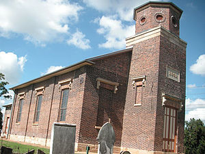
St Bartholomew's Anglican Church and Cemetery is a heritage-listed former Anglican church and cemetery at Ponds Road, Prospect, City of Blacktown, New South Wales, Australia. It was designed by Henry Robertson and built from 1838 to 1840 by James Atkinson. It was added to the New South Wales State Heritage Register on 2 April 1999.

Veteran Hall Remains
Historic site in New South Wales, Australia
Distance: Approx. 1485 meters
Latitude and longitude: -33.8109,150.9165
The Veteran Hall Remains are the heritage-listed archaeological remains of the former Veteran Hall house at Great Western Highway, Prospect, City of Blacktown, New South Wales, Australia. Veteran Hall was built in 1821 by William Lawson. The property is owned by Sydney Water.

Prospect dolerite intrusion
Landform of Sydney
Distance: Approx. 606 meters
Latitude and longitude: -33.825,150.91805556
The Prospect dolerite intrusion, or Prospect intrusion, is a Jurassic picrite or dolerite laccolith that is situated in Sydney, New South Wales, Australia. Lying in the heart of Cumberland Plain, in the suburb of Pemulwuy (previously Greystanes), the intrusion is Sydney's largest body of igneous rock, rising to a height of 117 metres (384 ft) above sea level. The site is formed by an intrusion of dolerite rock into Ashfield Shale.

Grey Box Reserve
Nature reserves in Australia
Distance: Approx. 759 meters
Latitude and longitude: -33.825713,150.9313571
The Grey Box Reserve, or Greystanes Grey Box Reserve, is a small nature reserve situated in the suburb of Greystanes, New South Wales in Western Sydney, Australia. A remnant bushland of the Cumberland Plain Woodland, it mainly features native vegetation. The reserve is so-named because of its abundance of Eucalyptus moluccana, reflecting the pre-European cultural landscape of the area.
Weather in this IP's area
clear sky
9 Celsius
9 Celsius
8 Celsius
10 Celsius
1021 hPa
59 %
1021 hPa
1011 hPa
10000 meters
0.89 m/s
4.02 m/s
248 degree
06:51:38
17:13:44