Country:
 Australia
Region:
City:
Latitude and Longitude:
Time Zone:
Postal Code:
IP information under different IP Channel
ip-api
Country
Region
City
ASN
Time Zone
ISP
Blacklist
Proxy
Latitude
Longitude
Postal
Route
IPinfo
Country
Region
City
ASN
Time Zone
ISP
Blacklist
Proxy
Latitude
Longitude
Postal
Route
MaxMind
Country
Region
City
ASN
Time Zone
ISP
Blacklist
Proxy
Latitude
Longitude
Postal
Route
Luminati
Country
 US
USASN
Time Zone
America/Chicago
ISP
INVESCO
Latitude
Longitude
Postal
db-ip
Country
Region
City
ASN
Time Zone
ISP
Blacklist
Proxy
Latitude
Longitude
Postal
Route
ipdata
Country
Region
City
ASN
Time Zone
ISP
Blacklist
Proxy
Latitude
Longitude
Postal
Route
Popular places and events near this IP address

Lake Tuggeranong College
Public school in Tuggeranong, Australian Capital Territory, Australia
Distance: Approx. 345 meters
Latitude and longitude: -35.414,149.068
Lake Tuggeranong College is an Australian Capital Territory public school catering to Year 11 and 12 students (aged between 16 and 20 years). It is located in the Tuggeranong, Canberra, close to Tuggeranong Town Centre and on the shores of Lake Tuggeranong in Greenway. The principal is David Briggs.

Lake Tuggeranong
Artificial lake in Australian Capital Territory
Distance: Approx. 846 meters
Latitude and longitude: -35.40833333,149.06666667
Lake Tuggeranong, an artificial lake sourced by the confluence of Tuggeranong Creek and stormwater discharge from urban and rural areas, is located in the Tuggeranong district of Canberra, within the Australian Capital Territory, Australia. The lake is situated adjacent to the Tuggeranong Town Centre, and is bounded by the suburbs of Bonython in the south-east and Kambah in the north-west.
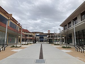
Tuggeranong Town Centre
Place in Australian Capital Territory
Distance: Approx. 167 meters
Latitude and longitude: -35.417,149.066
Tuggeranong Town Centre is the town centre of the district of Tuggeranong in the Australian Capital Territory. It is located on the south-western side of Lake Tuggeranong and composed of a large two-storey mall called South.Point Tuggeranong, as well as smaller shopping complexes, the Homeworld, and Tuggeranong Shopping Square, and many other buildings and shops. It is also the location of the Tuggeranong Interchange, a youth centre, a bowling alley, Tuggeranong Skate Park, the Tuggeranong Arts Centre and Lake Tuggeranong College.

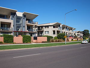
Bonython, Australian Capital Territory
Suburb of Canberra, Australian Capital Territory
Distance: Approx. 2295 meters
Latitude and longitude: -35.431,149.082
Bonython () is a suburb of Tuggeranong, a township in southern Canberra, capital city of Australia.
Greenway, Australian Capital Territory
Suburb of Canberra, Australian Capital Territory
Distance: Approx. 523 meters
Latitude and longitude: -35.418,149.07
Greenway is a suburb in the Canberra, Australia district of Tuggeranong. The postcode is 2900. The suburb is named after the architect, Francis Greenway (1777–1837).
South.Point Tuggeranong
Shopping center in Greenway, Australia
Distance: Approx. 152 meters
Latitude and longitude: -35.4164,149.0664
South.Point Tuggeranong (previously Tuggeranong Hyperdome) is a two-storey regional shopping centre located in Greenway, Australian Capital Territory, servicing the district of Tuggeranong.

Stranger Pond
Artificial lake in Bonython, Australian Capital Territory
Distance: Approx. 1610 meters
Latitude and longitude: -35.42972222,149.06972222
Stranger Pond, a series of two artificial lakes sourced from stormwater discharge from urban and rural areas, are located in the Tuggeranong district of Canberra, within the Australian Capital Territory, Australia. One is called 'Upper Stranger Pond' and is located in the suburb of Isabella Plains. The other is called 'Lower Stranger Pond' and is located in the suburb of Bonython.
Trinity Christian School, Canberra
Independent, day school in Canberra, Australian Capital Territory, Australia
Distance: Approx. 2135 meters
Latitude and longitude: -35.4082,149.0865
Trinity Christian School, founded in 1980, is a private Christian P-12 school located in Wanniassa in the Tuggeranong Valley of Canberra, ACT, Australia.

Pine Island Reserve
Distance: Approx. 1976 meters
Latitude and longitude: -35.43305556,149.07
Pine Island Reserve, a reserve containing a small plantation of pine trees, is located on the Murrumbidgee River where the river flows through the Tuggeranong district of Canberra, in the Australian Capital Territory, Australia. The closest suburb to the reserve and river island is Greenway. Pine Island is usually accessible by land and only becomes an island in time of peak flows in the Murrumbidgee River.
Canberra Roller Derby League
Roller derby league
Distance: Approx. 201 meters
Latitude and longitude: -35.41496389,149.06294167
The Canberra Roller Derby League (CRDL) is a Canberra-based roller derby league. It was created in 2008, with the first bouts occurring in 2009. Canberra currently holds the Division 1 trophy for The Great Southern Slam.

Southern Cross Stadium
Distance: Approx. 201 meters
Latitude and longitude: -35.41496389,149.06294167
The Southern Cross Stadium is a multi-purpose stadium in Tuggeranong, Canberra, primarily used for basketball. The venue has hosted the Canberra Roller Derby League. It is also the alternate venue for the University of Canberra Capitals of the Women's National Basketball League (WNBL).

Tuggeranong Interchange
Distance: Approx. 144 meters
Latitude and longitude: -35.4146,149.0655
Tuggeranong Interchange is located in Tuggeranong Town Centre, Canberra. All services are operated by ACTION. It consists of 7 platforms and provides connections between bus routes servicing the District of Tuggeranong. The bus station is located next to South.Point Tuggeranong on a section of Pitman St between Holwell and Anketell Streets which is closed to regular vehicular traffic.
Weather in this IP's area
clear sky
1 Celsius
-1 Celsius
-0 Celsius
3 Celsius
1035 hPa
81 %
1035 hPa
963 hPa
10000 meters
1.54 m/s
190 degree
9 %
07:01:32
17:18:41